About
Nala Municipality
Who is
Nala Muncipality
The Nala Local Municipality is situated in the northern part of the municipal region of the Lejweleputswa district council. The former Bothaville and Wesselsbron traditional local councils and a section of the Vetvaal transitional rural council have been combined to the new Nala local municipality.
The Bothaville/Kgotsong area is located approximately 50km south of Klerksdorp, 80 km north of Welkom and 200 km south of Gauteng. Wesselsbron/Monyakeng is situated approximately 70 km south-west from Bothaville, approximately 35 km west of Welkom/Odendaalsrus and 55 km east of Hoopstad. The major towns that form part of the Nala Local Municipality are Bothaville and Wesselsbron.

Climate
The climate of the area is typical of the South African Highveld climate zone. The summers are predominantly warm to hot (November to February), and the area falls within the summer rainfall area. Rainfall is predominantly in the form of thunderstorms with the associated lightning and occasional hail. The annual rainfall for the Free State ranges from 80mm to 800mm, occurring mainly in summer. Occasional heavy rainfall events of 125mm to 150mm transpire in short periods of time, usually a couple of hours, due to intensive thunderstorms or cloud bursts, resulting in floods that cause extensive environmental, economical and social damage. The region experiences severe frost, but little snow. Temperatures vary between 13 degrees Celsius and 35 degrees Celsius, with an average of 14 degrees Celsius.
Biodiversity Summary
The municipality covers an area of 412879.7ha of which 34.9% has remained as natural habitat. There are two formal land-based protected areas covering 16.9ha in the municipality. These are the Bloemhof Dam Nature Reserve and the Wolwespruit Nature Reservce. There are no RAMSAR sites in the municipality. There are two biomes in the municipality, namely Grassland and Savanna. Six vegetation types, are found in the municipal area. There is one endangered ecosystem, namely Vaal-Vet Sandy Grassland covering 70595ha (7.9%) of the municipality.
Topography
The topography of the area is homogenous, with moderate slopes. The only significant natural feature is the sensitive wetland system found just south of Wesselsbron. The Vaal River forms the north-western boundary of the municipality.
Towns of Nala Municipality
Wesselsbron
Location
It is a small maize farming town 75 kilometres south of Bothaville in Free State province of South Africa. The town is in close proximity of Welkom/Odendaalsrus. The Vet River flows just south of the Wesselsbron district and forms the southern boundary of the Nala region.
History
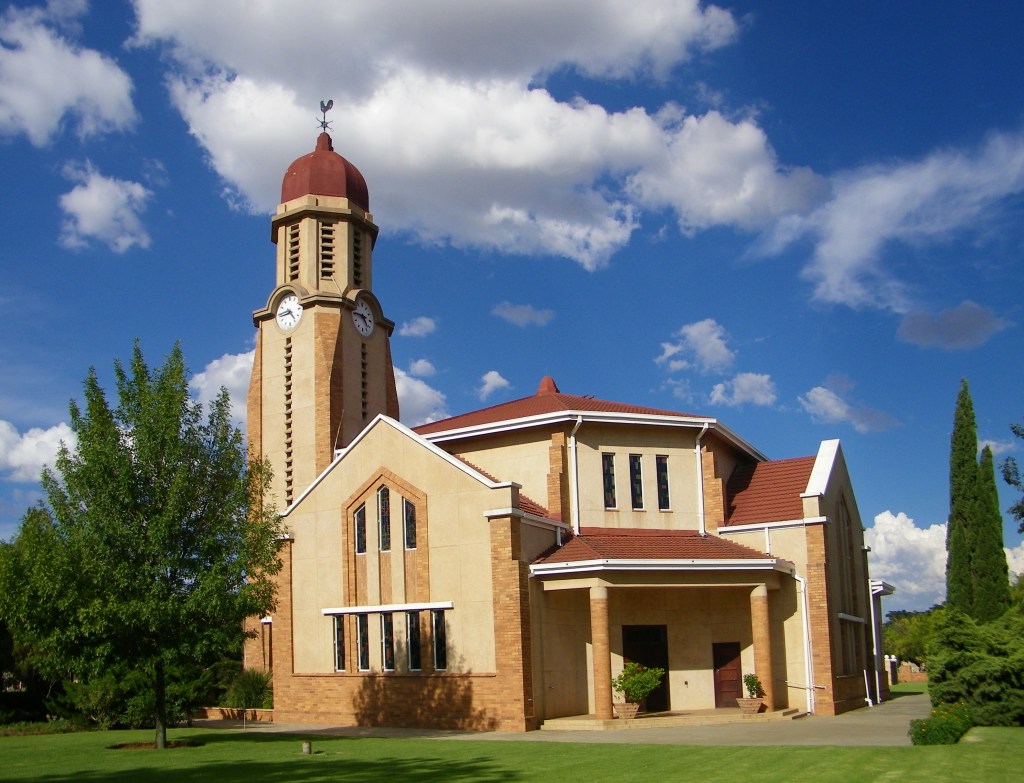
It was named after the Boer Commandant Cornelius Wessels who led the 1899 Siege of Kimberley during the Second Boer War. The first erven were sold as early as 1920 and the town was granted municipal status in 1936. The largest grain silo’s in the world is found at Wesselsbron.
Economy
A small town, serving a prosperous agricultural community, Wesselsbron boasts one of the largest grain silos in the southern hemisphere. The main agricultural activities include mealies and cattle farming. The community of Wesselsbron has opened their farms and businesses to the tourist trade.
Bothaville
Location
Bothaville is a maize farming town situated near the Vaal River in the Lejweleputswa DM of the Free State province, South Africa. It is situated 6km east of the Vaal, on the bank of its Vals River tributary.
History
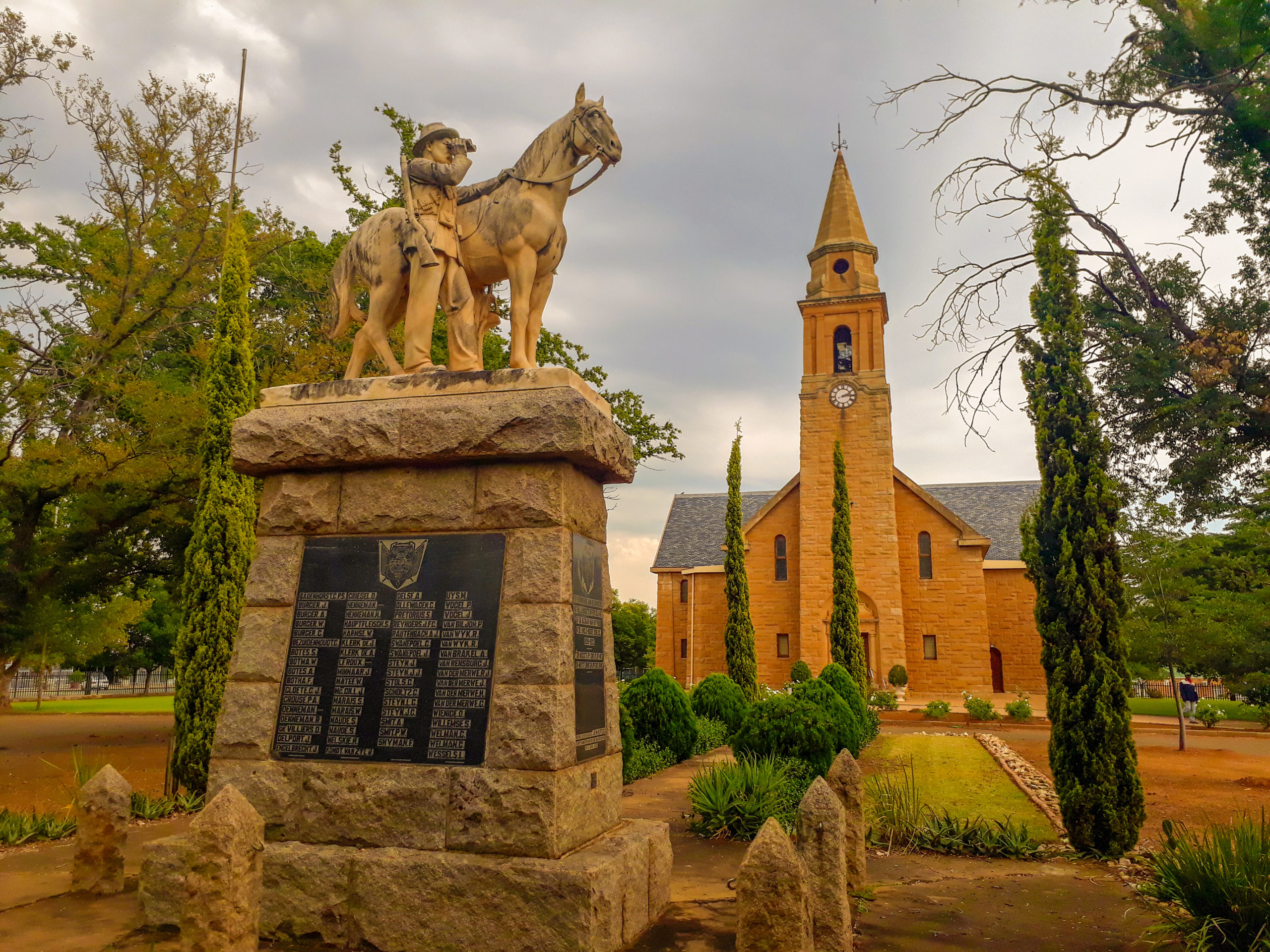
The area of present-day Bothaville was originally inhabited by Bushmen, while between the 15th and 70th century the Leghoyo Tswana tribe also settled in the area. Whites settled down permanently since 1852. Bothaville’s humble beginning was as Botharnia in 1891, as a ‘church town’, with the name changing to the current name in 1893. It was laid out on the farm Gladdedrift, which was owned by Theunis Louis Botha. It became a municipality in 1914.
The Battle of Doornkraal took place some distance south of town on 6 November 1900. Doornkraal Monument is a granite memorial built in honour of Boers who died here in the surprise attack by British soldiers. Some of the Boer soldiers were buried in a communal grave.
Economy
Bothaville hosts the head office of Grain South Africa and produces annually an average of 550 000 tons of maize. Situated on the banks of the Vals River, the town is considered to be one of the richest agricultural communities in the country. The town forms one of the corners of the maize triangle and maize is produced in the district.
Other agricultural activities focus on dairy, wheat, sunflower, nuts and vegetables. The town has a factory that manufactures agriculture machinery and tractors. A municipal airstrip of 1,2km with tarmac surface and night landing facilities is situated next to the industrial town. Bothaville is strategically located close to the gold mining towns of Klerksdorp/Orkney.
Other
Local
Municipalities
Lejweleputswa District Municipality
The name Lejweleputswa, meaning ‘gray rock’, describes the area in the Free State with a history rich in gold prospecting and mining. The Lejweleputswa district is rich in gold deposits and lies at the heart of the province’s goldfields.
Masilonyana Local Municipality
The Masilonyana Local Municipality (FS181) was established in term of the Municipal Structure Act and the Municipal Demarcation Act. The municipality forms part of Lejweleputswa District Municipality (FS184). The municipality head office, Theunissen is situated 102 kilometers from Bloemfontein and approximately 55 kilometers from Welkom.
Matjhabeng Local Municipality
Matjhabeng Local Municipality came into existence on 05 December 2000 after the amalgamation and emergence of the former six (6) Transitional Local Council into one (1) financially viable and economically sustainable municipality.
Tokologo Local Municipality
Tokologo Local Municipality is located within Lejweleputswa District Municipality, specifically in the western Free State. The area covers 9 326 square kilometres and consists of three former Transitional Local Councils namely Boshof, Dealesville and Hertzogville
Tswelopele Local Municipality
The municipality covers an area of 652407.2ha of which 47 % has remained as natural habitat. There are two formal land-based protected areas covering 16.9ha in the municipality. These are the Bloemhof Dam Nature Reserve (632ha) and the Sandveld Nature Reserve (24883.5ha).
Spatial Description
The Nala Local Municipality is situated in the northern part of the municipal region of the Lejweleputswa district council. The former Bothaville and Wesselsbron traditional local councils and a section of the Vetvaal transitional rural council have been combined to the new Nala local municipality.
The Bothaville/Kgotsong area is located approximately 50km south of Klerksdorp, 80 km north of Welkom and 200 km south of Gauteng. Wesselsbron/Monyakeng is situated approximately 70 km south-west from Bothaville, approximately 35 km west of Welkom/Odendaalsrus and 55 km east of Hoopstad. The major towns that form part of the Nala Local Municipality are Bothaville and Wesselsbron.
Environmental Profile
Biodiversity Summary
The municipality covers an area of 412879.7ha of which 34.9 % has remained as natural habitat. There are two formal land-based protected areas covering 16.9ha in the municipality. These are the Bloemhof Dam Nature Reserve and the Wolwespruit Nature Reservce. There are no RAMSAR sites in the municipality.
There are two biomes in the municipality, namely Grassland and Savanna. Six vegetation types, are found in the municipal area. There is one endangered ecosystem, namely Vaal-Vet Sandy Grassland covering 70595ha (7.9%) of the municipality.
Climate
The climate of the area is typical of the South African Highveld climate zone. The summers are predominantly warm to hot (November to February), and the area falls within the summer rainfall area. Rainfall is predominantly in the form of thunderstorms with the associated lightning and occasional hail. The annual rainfall for the Free State ranges from 80mm to 800mm, occurring mainly in summer. Occasional heavy rainfall events of 125mm to 150mm transpire in short periods of time, usually a couple of hours, due to intensive thunderstorms or cloud bursts, resulting in floods that cause extensive environmental, economical and social damage. The region experiences severe frost, but little snow. Temperatures vary between 13 degrees Celsius and 35 degrees Celsius, with an average of 14 degrees Celsius.
Topography
The topography of the area is homogenous, with moderate slopes. The only significant natural feature is the sensitive wetland system found just south of Wesselsbron. The Vaal River forms the north-western boundary of the municipality.
STRATEGIC OBJECTIVES
To build and enhance our governance system that is founded on democratic values in order to improve service delivery
To enhance our institutional capacity in order to instil a culture of high performance through proper facilitation of transformation and development
To strengthen our financial management system in order to sustain our viability and developmental local government functioning
To ensure adequate and equitable access to quality and affordable services across the municipality in order achieve a better life for all
To improve our local economic development in order to stimulate and facilitate economic growth and social cohesion
LEGISLATIVE FRAMEWORK
The Nala Local Municipality was formed after the amalgamation of the former Bothaville and Wesselsbron transitional local councils and a section of the Vetvaal transitional rural council.